
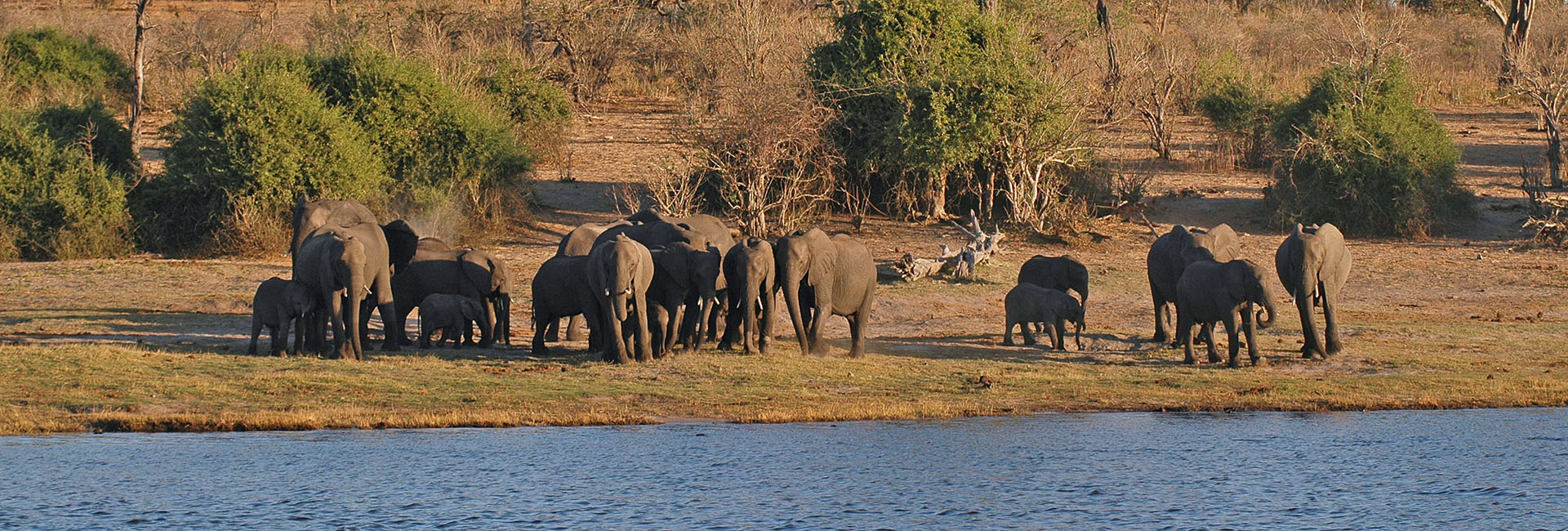
BIODIVERSITY
In an ever-changing world, the conservation of natural resources and the promotion of biodiversity is of crucial importance. We support conservation measures all around the world through ecosystem assessments, protected area planning and management, habitats directive reporting and vulnerability analyses.

CONSERVATION
Monitoring land use change and habitat conditions is an integral part of natural resource management. We provide independently processed geospatial data concerning numerous environmental parameters and support customers looking to manage natural resources responsibly.
WETLAND MONITORING
WETLANDS
Wetlands are one of the most valuable and most diverse ecosystems, but are also one of the most threatened habitats on our planet. RSS is creating innovative wetland monitoring tools and methodologies that employ Earth observation data. These allow revealing a diversity of information about the status of wetland ecosystems, anthropogenic wetland uses and disturbances. The results guide sound decision making and sustainable policies and support authorities in implementing wetland management and conservation strategies.
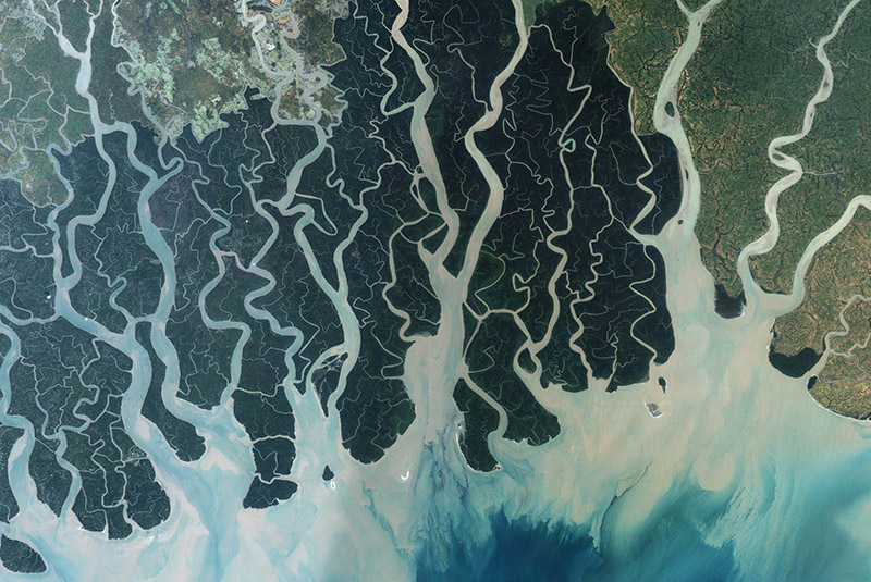
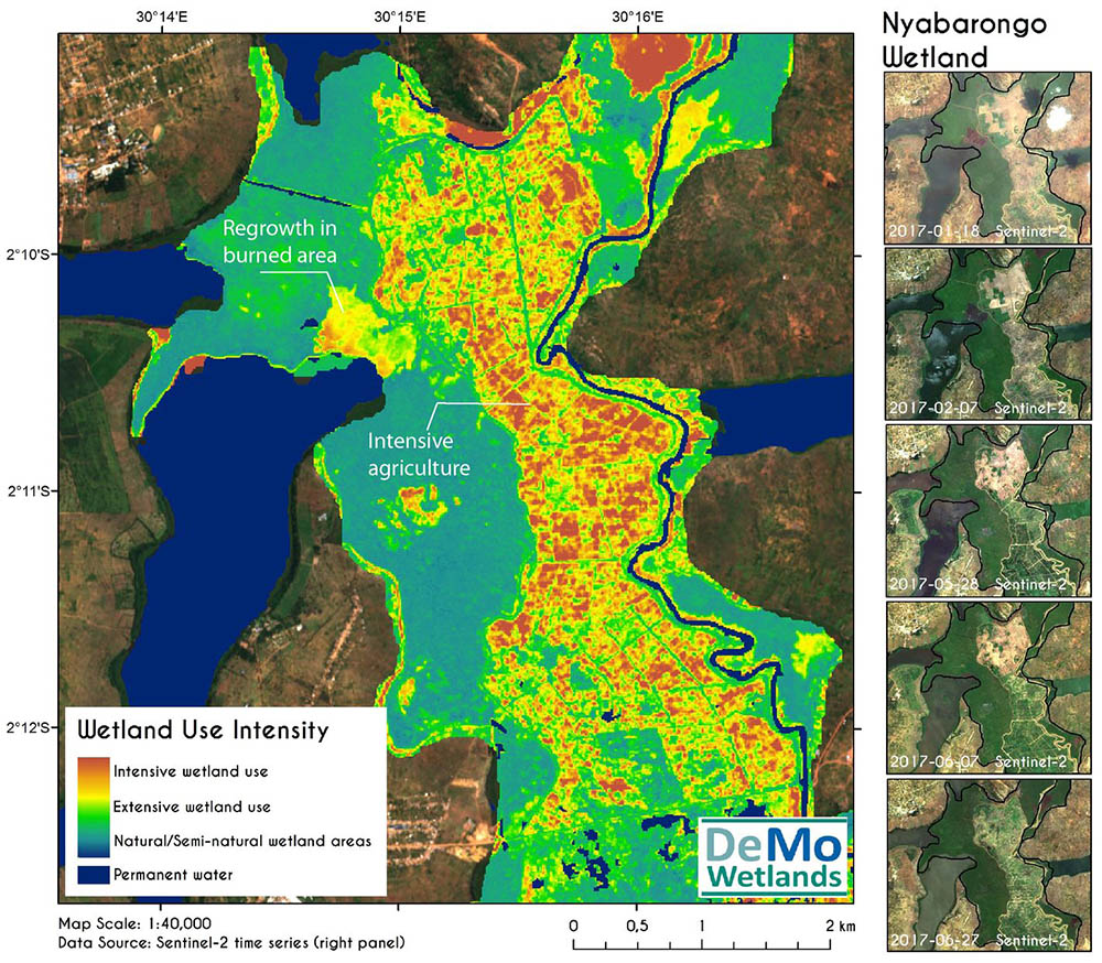
WETLAND STATUS & THREADS
By making use of the full potential of free satellite data, detailed yet national and up-to-date spatial data sets on current and nationwide wetland extent and characteristics can be created. A variety of information products are provided in direct response to the requirements of national stakeholders, international conventions and initiatives such as Ramsar, GEO-Wetlands and the Sustainable Development Goals (SDGs). The products include wetland delineation, land use land cover maps (e.g. Ramsar or MAES nomenclature), surface water occurrence and wetland use intensity maps. These support governmental bodies and NGO’s in their conservation efforts, as well as national authorities in their reporting needs.
BIODIVERSITY
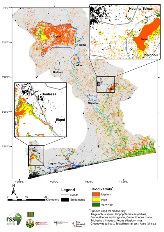
ASSESSMENT OF BIODIVERSITY
Multi-scale biodiversity mapping and monitoring tools can be used to understand biodiversity threats and help to identify biodiversity priority areas and their conservation status. The biodiversity-based conservation status mapping routines use specific landscape variables from remote sensing observations and species occurrence data from field surveys. The resulting maps with priority areas for protection can be used for community outreach and sensitization campaigns as well as to create awareness of habitat loss around important conservation areas. They can further be used in ecosystem services trade off analysis and for regular biodiversity status reporting by individual countries (i.e. through UNBD reporting obligations). The map shows a status map for Togo and Benin (the Mono River Delta area) using animal indicator species (occurrence data) and satellite variables.
PEATLANDS
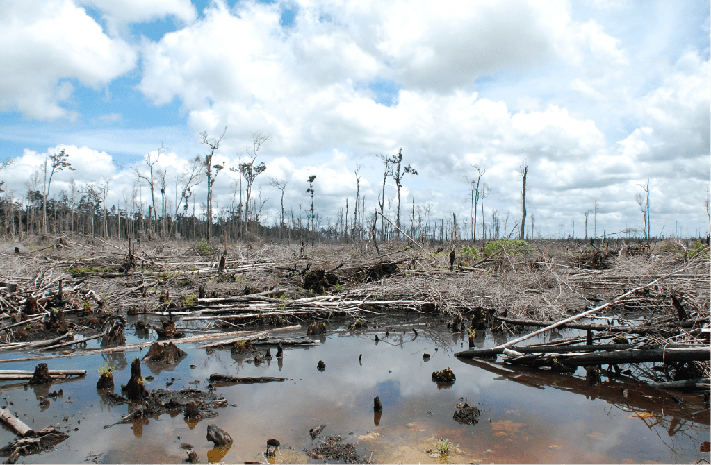
Tropical peatlands store immense amounts of carbon and are considered to be one of the globe's most important carbon sinks. These peatlands form when dead plant material is submerged under water and thereby preserved from bacterial decomposition. When the water table over peat is lowered, however, (e.g. for agricultural cultivation), peat becomes exposed to aerobic conditions, triggering bacterial decomposition, and emitting vast amounts of CO2 (among other greenhouse gases). Managing peatlands sustainably is therefore paramount to reducing emissions and mitigating climate change.
SUSTAINABLE MANAGEMENT
Sustainable management is no small task, especially in tropical peatlands where stress factors are abundant. Examples include agricultural cultivation on both smallholder and estate scales, forestry, settlement expansion, infrastructure construction and fires. It follows that conservation and rehabilitation - which focusses on preventing and reversing peatland drainage - represent the only realistic approaches for sustainable peatland management. Once integrated, these approaches preserve peat carbon sinks and reduce the emission of greenhouse gases in tropical peatlands.
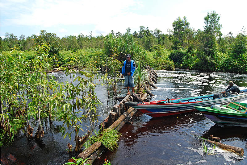
REWETTING OF DISTURBED PEATLANDS
Reversing peat drainage through rewetting stops bacterial decomposition and reduces GHG emissions. Unfortunately, reviving disturbed peat hydrology is no trivial task - it requires precise topography, hydrological network, water table and peat characteristic data. When combined, this information identifies where a blocked drainage canal would facilitate sustainably raised water tables, and thus minimize GHG emissions.
Peat fires are Major source of GHG emissions
Peat is a major source of carbon dioxide emissions when it burns or decomposes. In 2015 burning peatlands were responsible for 42% of Indonesia’s total emissions. In the devastating 2015 fire season forests and peat fires cost the Indonesian economy $16 billion and released 1.62 billion metric tons of this greenhouse gas. The deeper the peat is, the more ecological damage and carbon emissions result from disturbance. Uncertainty about the extent of peatland and particularly the depth of peat, has delayed protection and restoration measures.

Consulting


When it comes to services, we make quality, technological excellence and customer satisfaction our unvarying priority. To find out more, please select a theme - we look forward to assisting you.
