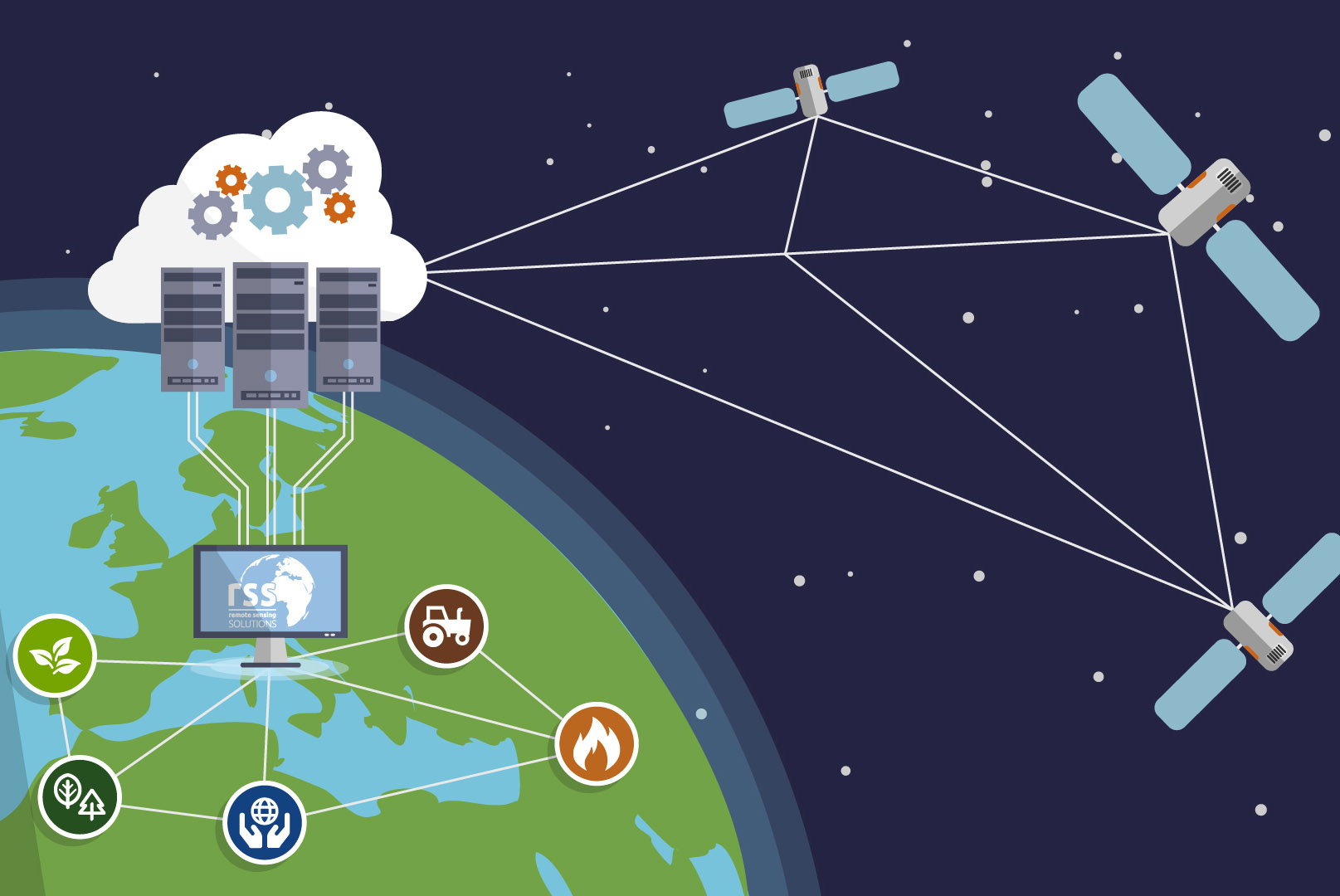
KEY TECHNOLOGIES
We use a broad range of most recent satellite instruments, new drone technology and airborne laser scanning to collect data and select the most appropriate system for our customers. For spatio-temporal data analysis we use geographical information systems (GIS) and machine learning algorithms for automatisation and big image data analyses.
TECHNOLOGY
Earth Observation draws on a diverse suite of satellite and airborne technology which is constantly developing and improving. This includes a history of satellites, modern additions like the Sentinels and very high-resolution satellites, airborne laser scanning technology as well as drones. Analyzing this diversity of data and long- and dense time series comes along with big data challenges. RSS is using modern IT-infrastructure such as cloud computing and innovative machine learning algorithms for deriving quantitative information for enhanced spatial decision support.
SATELLITES
ACTIVE AND PASSIVE SATELLITES
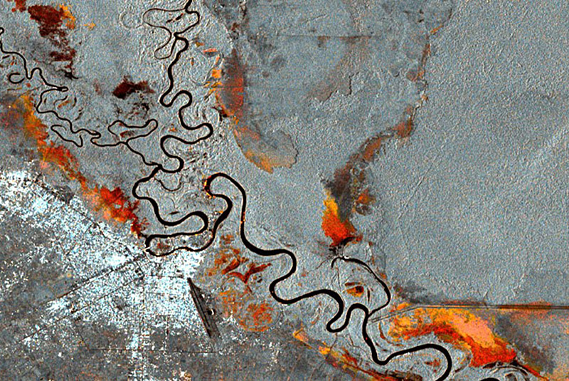
Satellites provide the core bulk of data that we work with. There are numerous satellites built for different applications, with differing spatial resolutions, revisit times, and operating systems. Some actively transmit energy and receive information about our planet (active sensors), while others rely on sunlight to image the globe (passive sensors). The most common data types we use are optical or SAR (Synthetic Aperture Radar). Many users are overwhelmed by the manifold satellite data sources that exist. We assist our clients in making the optimal selection of data in direct response to their information needs.
FEATURE EXTRACTION
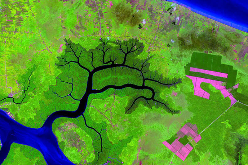
High resolution multispectral satellites allow detailed analyses of the vegetation cover including plant type, health and species diversity. Satellites that include the Red-Edge band are capable to discriminate young vs. mature plants, different field crops, conifers versus broad leafed trees and even detect crop health and maturity. RSS uses multispectral imagery to map and classify large areas with great detail to allow decision makers and planners more efficient responses and a better understanding of potential risks.
UAV
DRONES
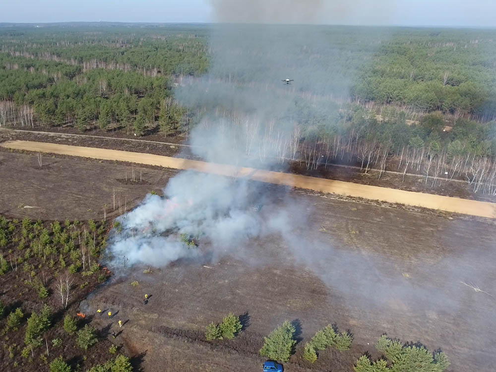
Drones are also known as unmanned aerial vehicles or UAVs, and are a relatively new addition to remote sensing technology. Although satellites exist that can match their quality, drones present a much more affordable or complementary solution when dealing with small study sites. Most systems on the market are built with a camera which can record video and images, but more complex systems are also equipped with LiDAR, thermal and other user-defined sensors.
RSS currently operates a fleet of drones and is developing further models for targeted environmental monitoring purposes. Our drones gather very fine resolution imagery for 3D models, detect thermal anomalies and more.
SURVEYING IN DIFFICULT TERRAIN
Drones are capable to access areas which are impossible to be explored on foot or by boat. Drones allow to collect data in remote areas and in unprecedented detail. Using photogrammetry drones allow to measure tree height. Using multispectral cameras drones can be used to discriminate species and to assess biodiversity.
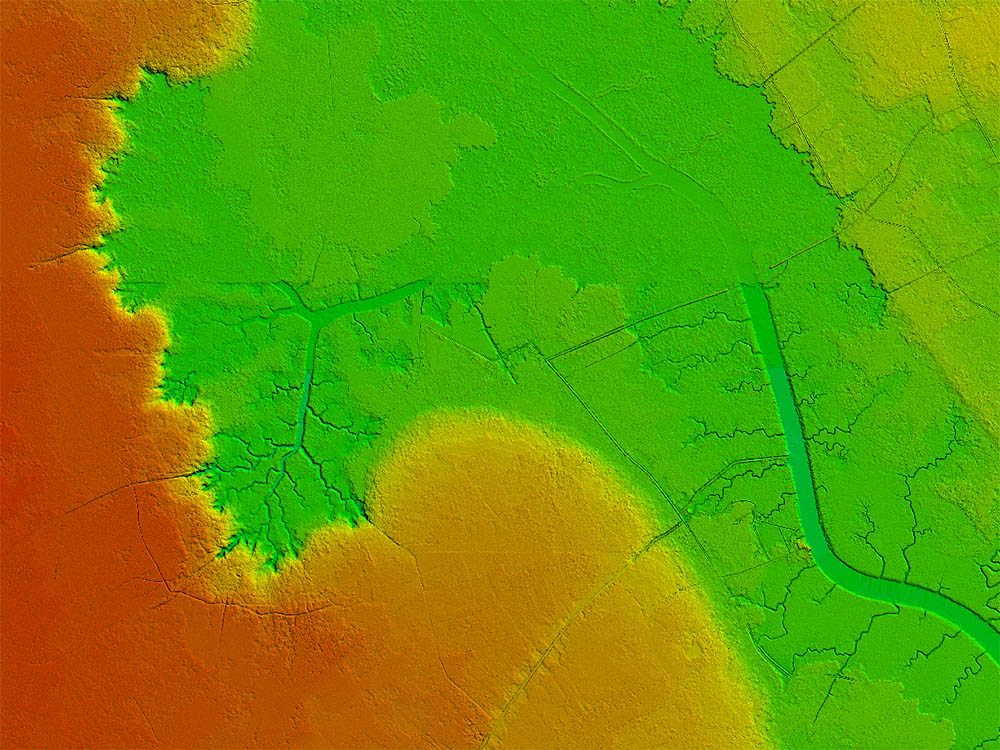
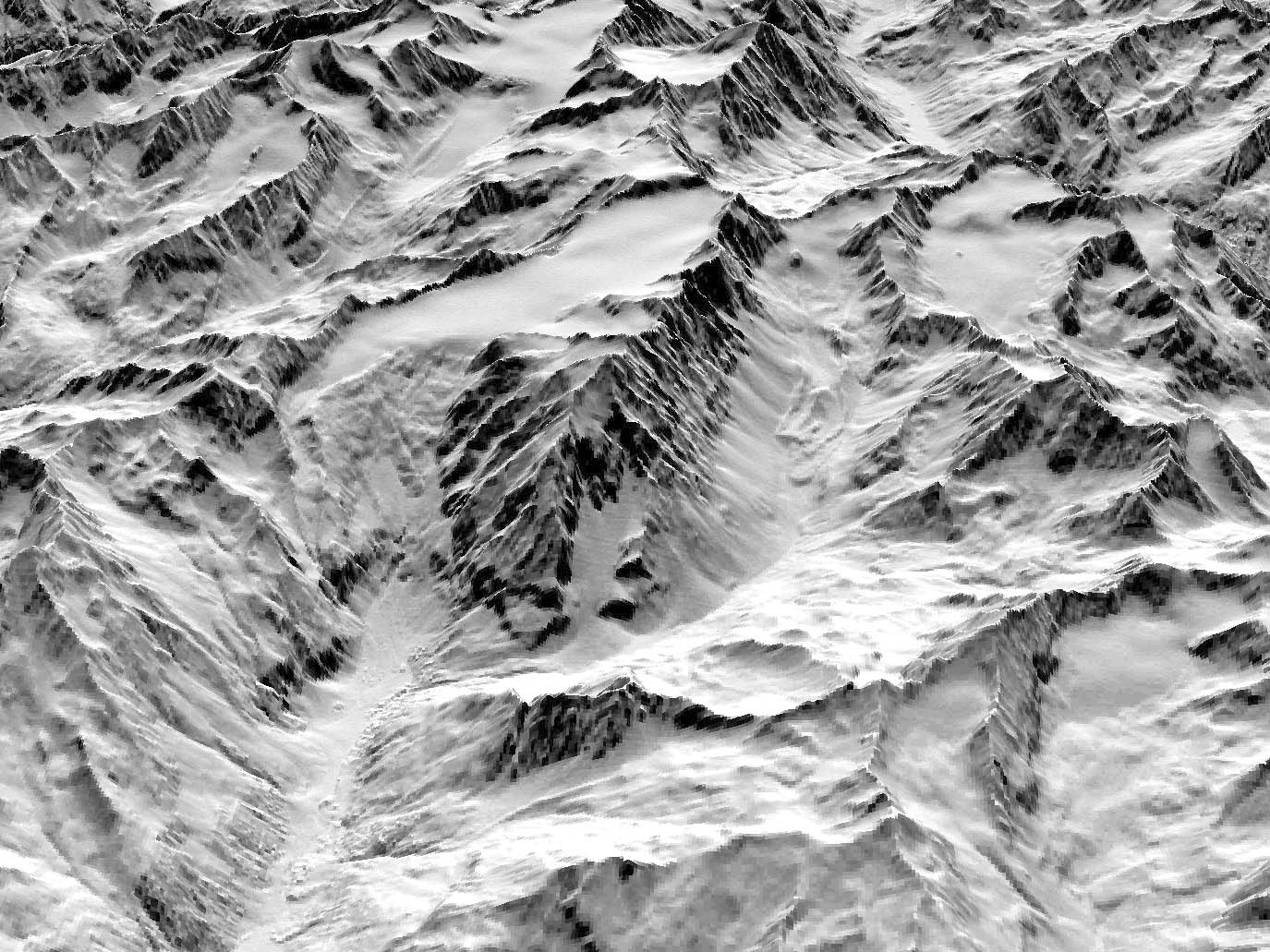
TERRAIN MODELS
Terrain models are highly useful data sets for analyzing and visualizing the changing landscape of our planet. Digital elevation models (DEM) represent the elevation of Earth’s surface, including features such as vegetation and buildings. A digital terrain model (DTM) provides a bare earth representation of surface topography. RSS uses terrain models in hydrologic analyses such as flood or drainage modeling, hazard monitoring, land-use studies and natural resources management..
AIRBORNE LASER SCANNING
Scanning the Earth's
surface in 3D
Light Detection And Ranging (LiDAR) is an additional active system which uses laser pulses to scan the environment with extremely fine detail. LiDAR is traditionally collected by airplane but can also be collected by satellite or drone. Each platform generates a point cloud which can be processed further into highly accurate digital terrain models, digital surface models and 3D products. When coupled with aerial imagery or other spatial products, these powerful systems support a wide range of applications from spatial planning to forest management.
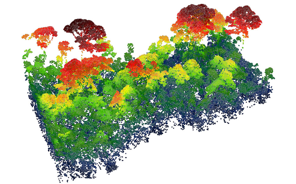
Scanning the vegetation structure
Light Detection And Ranging (LiDAR) is an additional active system which uses laser pulses to scan the environment with extremely fine detail. LiDAR is traditionally collected by airplane but can also be collected by satellite or drone. Each platform generates a point cloud which can be processed further into highly accurate digital terrain models, digital surface models and 3D products. When coupled with aerial imagery or other spatial products, these powerful systems support a wide range of applications from spatial planning to forest management.
DIGITAL PHOTOGRAMMETRY
Very high resolutions terrain models
Highly accurate, current spatial information is the basis of many planning and decision-making processes. Digital photogrammetry is a new technique for acquiring dense 3D geometric information for real-world objects from stereoscopic image overlap. RSS processes digital images acquired by satellites, airplanes and drones to generate products like highly accurate true orthophotos, digital terrain models (DTM) and digital surface models (DSM).
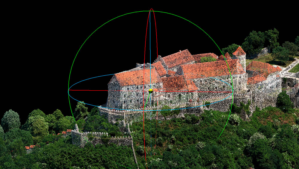
3D reconstruction
3D reconstruction is a technology to generate 3D Objects from a set of aerial pictures taken from drones and airplanes at different angles with stereoscopic image overlap. A 3D surface model is then constructed using digital photogrammetry algorithms. RSS produces high resolution 3D models of landscapes, vegetation covers or building complexes which can be visualized in 3D and further analysed. The spatial resolution ranges from 100 cm up to 4 cm.
DATA ANALYSIS
GEOGRAPHICAL INFORMATION
SYSTEMS
New information products can be derived by a combined analysis of geospatial data from satellites and other thematic backgrounds that assist in practical decision making. Imagery from satellites combined with vector data that represents Earth system features are analyzed in Geographic Information Systems (GIS) and data science frameworks. We use data-driven approaches to help to better understand and communicate complex processes in ecosystems.
CLOUD-COMPUTING &
MACHINE LEARNING
As geospatial science develops, data is becoming available at more regular intervals and in larger quantities. The heightened bulk of information means we can start to explore big-picture questions which were impossible to tackle before - especially events that occur over brief periods, or those that deal with slow changes over long periods of time. At the same time, the mass of data also translates to computational demands of unprecedented magnitudes. RSS provides cloud-based and server-based solutions for automated data processing and machine learning algorithms to deeply investigate environmental changes over time and provide our customers with the highest processing speeds.