
digital verification
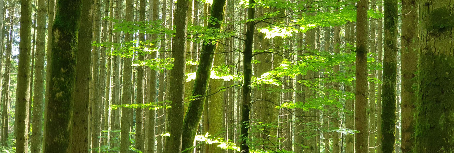
We offer "Software as a Service" (SaaS) solutions in the areas of AI-based forest inventory, CO2 accounting, forest monitoring and digital verification of sustainable forest management.

climate projects
RSS combines high-resolution earth observation data with AI-based analytics for accurate digital characterization and continuous monitoring of forests. Our SaaS solutions can be used to meet the high standards of certification schemes or to verify sustainable forest management.


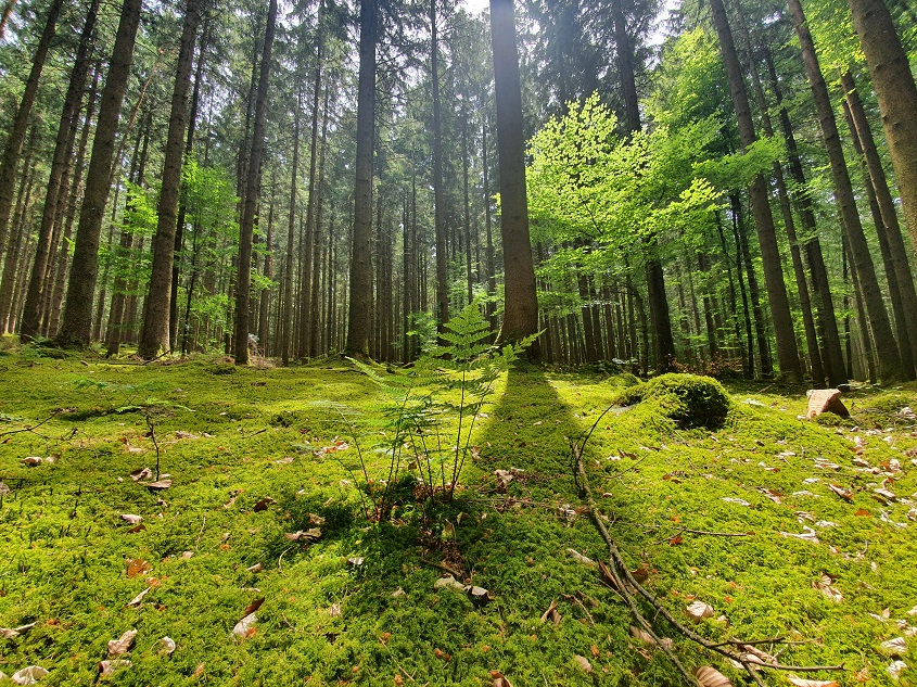
FOREST AS CO2-STORAGE
Forests continuously remove carbon dioxide from the atmosphere and store it in above-ground biomass (trunk, branches) and in slowly decomposing organic matter in litter and soil. Between 2001 and 2020, forests globally absorbed 7.35 Gt Co2 equivalents.
GERMANY
About one third of Germany's total area is forested - that's 11.4 million ha. This forest relieves the atmosphere of about 62 million t CO-2 annually, offsetting about 7% of Germany's emissions. A total of 1,230 million t CO-2 are bound in German living trees.
GLOBAL
Worldwide, forests cover about 30% of the land area and store over 660 Gt of CO2. Up to 50% of this is in living above-ground biomass.
FOREST PROTECTION AS CARBON STORAGE OPPORTUNITY
In the future, the forest ecosystem will not only be protected in terms of biodiversity and economic development.
Forest protection does not only counteract deforestation°radation, but also reduces the resulting CO2 emissions.
This is already remunerated at EU level in the LULUCF (Land Use, Land Use Change and Forestry) sector regulation. Each member state will be obliged to compensate for land use changes that cause CO2 emissions through better, sustainable management of forest areas or through afforestation.
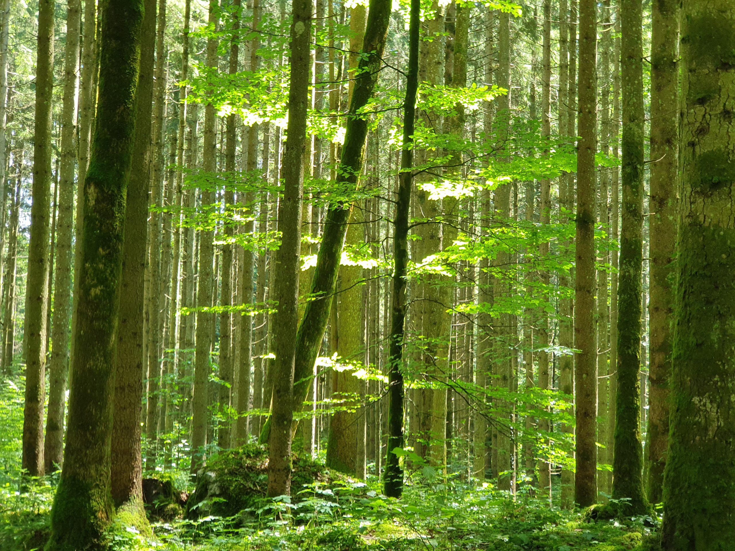
FOREST CONVERSION & CLIMATE CHANGE
The loss of global tree cover over the last 20 years is 411Mha and is equivalent to a 10% reduction in forest cover and CO2 emissions of 165Gt.
In addition to commodity-driven deforestation for fuel/construction timber, natural disasters and pests also play a role. Through continuous monitoring, early detection measures and preventive measures, it is possible to counteract deforestation°radation of the forest ecosystem.
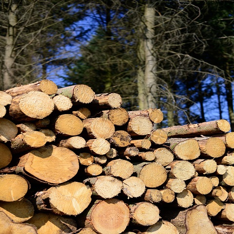
The methods and products used by RSS help forest owners to develop and implement long-term solution concepts for sustainable forest development.
Data Acquisition
For transparent accounting of the carbon sequestration of forests, an accurate inventory of the carbon stock and its changes is essential. With the help of transparent and standardized methods of earth observation, it is not only possible to support more sustainable forest management, but also to estimate the emission reduction potential. The full coverage of the remote sensing-based inventory allows the area-wide complemention of information from in-situ sampling methods.
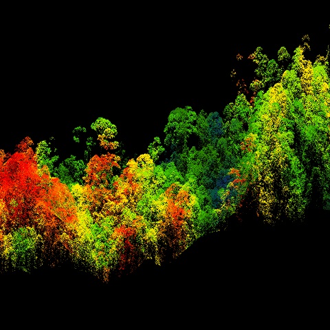
RSS' SaaS solutions combine high-resolution earth observation and AI-based algorithms to automatically derive and characterize tree cover in terms of tree heights and biomass content. The combination of these methods provides an accurate digital twin of the forest stand. RSS is a one-stop shop for everything from data collection and analysis to digital delivery of results via web-mapping solutions.
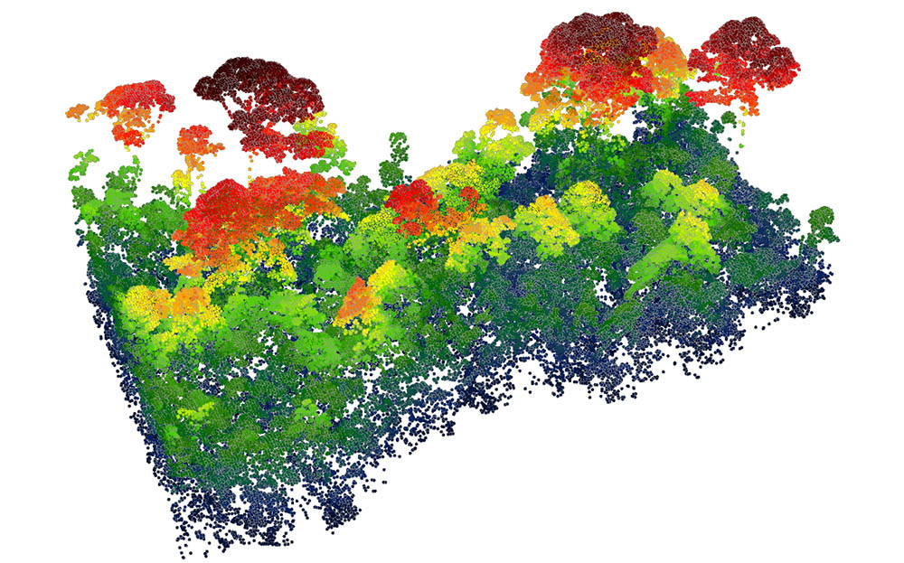
Digital Twin of your Forest
To capture individual areas digitally, we use drones or small aircraft for higher-resolution data collection in addition to satellite-based solutions. Depending on the desired ground resolution, data acquisitions of up to 25 km² are possible in one day. Matching the required specification of our customers, we are able to carry out data acquisition with sensor technology individually adapted to the purpose. We use airplane- and drone-borne systems like laser scanning (LiDAR) for forest surveying in 3D, specialized multispectral sensors to derive information on forest type and stress factors, and thermal sensors to draw conclusions about the water balance and cooling effect of forests.
All Data always available
RSS' solutions can be effortlessly integrated with existing Geographic Information Systems to optimize planning and workflow for your forest management. Data from the digital inventory can be directly compared and enriched with other data from terrestrial measurements. In addition to that, we offer online solutions that allow the visualization and interactive exploration of the forest condition in web-mapping solutions.
CO2 – Accounting
Forests are biodiversity hotspots, store large amounts of carbon in their above and below ground biomass, and provide various ecosystem services to local communities. RSS has supported REDD+ (Reducing Emissions from Deforestation and Forest Degradation) projects through technical MRV (Monitoring, Reporting and Verification) since the beginning of forest-related carbon projects. Our developed methods are also applicable in afforestation and reforestation projects, as well as sustainable forest management.
The possibility of offsetting CO2 emissions and setting aside forests as compensation areas created financial incentives for private investors and investors in the form of CO2 certificates. Our SaaS products are specifically tailored to meet the requirements of the high standards of the "Verified Carbon Standard", "Gold Standard" and the "High Carbon Stock Approach" for forest climate projects.
CARBON OFFSETTING
CO2-Certificates
If a company wants to emit carbon dioxide into the atmosphere, it needs emission rights in Europe. A CO2 certificate entitles the holder to produce one ton of carbon dioxide within a specified period. At the end of the specified period, the company must prove that all its emissions are covered by certificates. It must buy these certificates through the European Emissions Trading Scheme - so companies incur additional costs.
So emitting less CO2 is economically better for a company. Moreover, since the beginning of 2019, the surplus of emission certificates has been reduced and thus a significant increase in the price of CO2 certificates can be assumed.
Quality Standards for carbon projects
Assessing and ensuring the environmental and climate impact of a (forest) project is complex in practice. With many years of experience in carbon accounting and forest monitoring, RSS has been actively involved in the development of quality standards. This fundamental knowledge of the practical application of quality standards is reflected in the solutions we develop. They enable an exact carbon and CO2 accounting of forest areas that allows becoming active on the voluntary or mandatory compensation market.
Digital verification
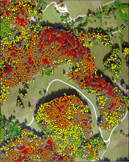
Forest owners who manage their forests in a climate-friendly and near-natural way should be rewarded, as they ensure that carbon is stored in wood and soils, biodiversity is preserved and the water balance is improved. We offer methods for digital verification of forests that meet the criteria of different sustainability standards. Therefore, we combine the latest technologies such as artificial intelligence and high-resolution Earth observation satellites to transparently, cost-effectively and independently evaluate whether biomass in forests is building up or degrading. This digital verification also allows for an estimation of the economic impact of near-natural management in terms of CO2- and sustainability certificates.
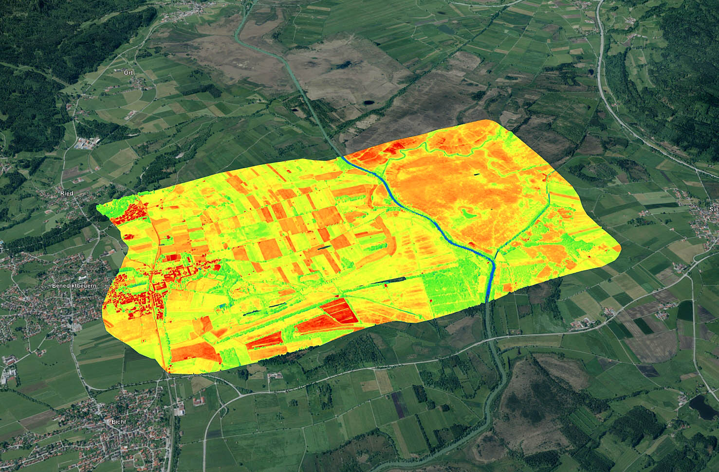
Interactive forest monitor Arnsberg
Forest monitoring
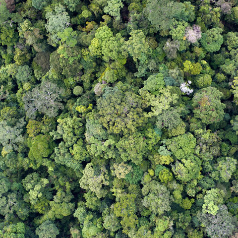
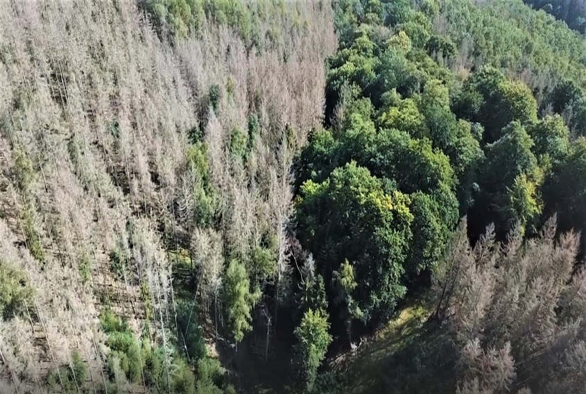
Our monitoring approach, which synergistically uses high-resolution aerial imagery and optical and radar satellite data, identifies the current condition of forests, the extent and density of forest cover, and their changes over time. Historical trends in deforestation and degradation are derived that can be compared to current and future activity data. We also use these data to spatially and temporally assess the impacts of wildfires, droughts, and pest infestations on the forest ecosystem.

Peatland Conservation
Peatlands not only make an important contribution to the preservation of biodiversity, but also fulfill another function: They are very effective carbon stores and can therefore make a significant contribution to reducing emissions. If a peatland is drained, the carbon is released primarily as carbon dioxide through biological degradation processes and the carbon store becomes a source of greenhouse gases. In Germany, up to 4% of CO2 emissions come from peatlands drained for agriculture. The rewetting of peat soils can play an outstanding role in achieving current greenhouse gas reduction targets.
Aerial data collection
In cooperation with ElektraSolar, RSS has developed a multi-sensor camera system that is particularly suitable for observing the success of peatland restoration. ElektraSolar's Solar One is an environmentally friendly, solar-electric powered ultralight aircraft specially developed for airborne environmental monitoring. The ultralight aircraft is equipped with a variable 5x oblique camera system, a multispectral camera and a thermal camera that record data simultaneously. The aircraft can be used at an altitude of just 300 meters above the ground. This increases the resolution and quality of the recorded data while at the same time lowering costs. In contrast to drones, the manned ultralight aircraft does not require any ascent permits and can therefore fly over populated areas and critical infrastructure without any problems. This is a major advantage over drones
PLANNING & MONITORING OF PEATLAND ECOLOGICAL RESTORATION
Combining multispectral and thermal data, conclusions can be drawn about the diversity of vegetation and soil moisture, which in turn allow conclusions to be drawn about the intensity of management and the condition of the bogs. The developed system can be used to find answers to a large number of environmentally relevant questions, especially when it comes to rewetting moors. Spatial data on vegetation growth, biodiversity and water saturation are particularly important to record the current state of the moors and the success of the renaturation measures. The aim is to be able to better assess the CO2 savings potential of initiated protective measures in connection with in situ data. And on the basis of this data, decisions for better protection of the remaining moor areas in Germany and Europe can be made more effectively.
Consulting


When it comes to services, we make quality, technological excellence and customer satisfaction our unvarying priority. To find out more, please select a theme - we look forward to assisting you.
