
FOREST RESOURCES
With more than 20 years of expertise in tropical forest monitoring we are one of the leading value-adding companies for measuring deforestation and forest degradation as well as forest fire assessments and biomass estimation and carbon accounting.

Forest Protection
RSS uses state-of-the-art monitoring and modelling techniques to provide valuable information on global forests. These services encompass but are not limited to Monitoring, Reporting and Verification (MRV) in the context of Reducing Emissions from Deforestation and Degradation (REDD+) and carbon accounting. We also specialize in mapping forests, in monitoring forest cover change and forest biomass and carbon stock assessments.
REDD+
Forests are biodiversity hotspots, store huge amounts of carbon in their above- and below-ground biomass and provide various ecosystem services to local communities. Unfortunately, land use intensification and unsustainable forest management practices lead to significant greenhouse gas emissions. The UN REDD+ program aims to reduce emissions from deforestation and forest degradation and aims at protecting and enhancing forest resources.
Voluntary carbon markets have emerged alongside UN-REDD+, which offer financial incentives for sustainable forest management. RSS has participated in REDD+ readiness and voluntary carbon projects since carbon accounting began, aiding projects ranging from technical consulting, forest monitoring and MRV-methodology development to capacity development among stakeholders.
FULL SERVICE PROVIDER
BASELINE ASSESSMENT
• Analysis of the historical forest inventory and its dynamics
• Analysis of the current forest inventory with AI
• CO2-Accounting
• Development of future scenarios for sustainable management
• Verification for CO2-Certificates
• Longtime monitoring
MONITORING, REPORTING AND VERIFICATION
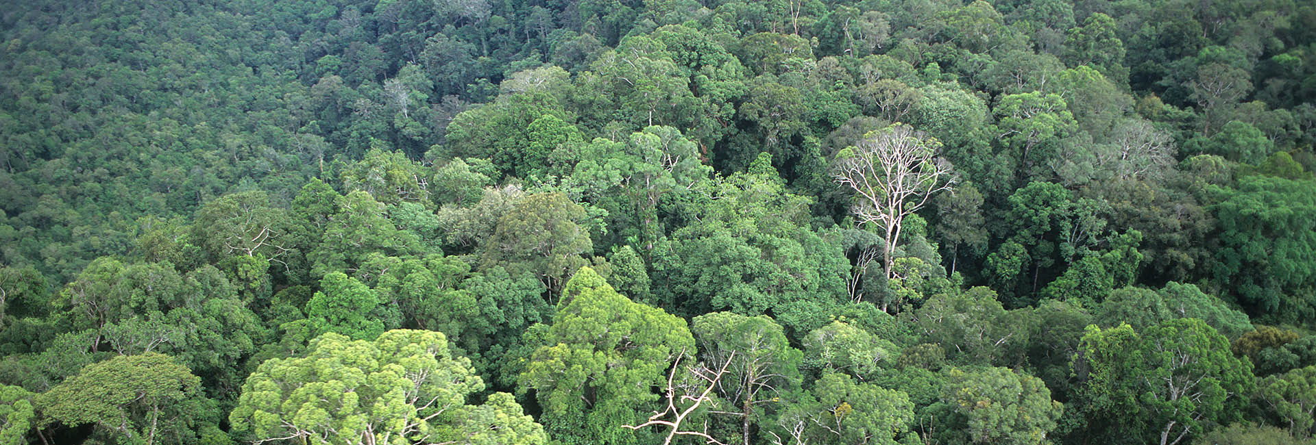
The RSS GmbH uses high-resolution optical and radar satellite data synergistically, thereby identifying the historical and current state of forests, the extent and density of forest cover, and their changes over time. Historical trends in deforestation, degradation, and tree species phenologies are derived.
.
To analyze the current forest cover, we use satellite-based solutions as well as drones or small aircraft for higher-resolution data collection, whereby AI methods can be used to determine the tree cover over a wide area and to identify main tree species.
RSS has been supporting REDD+ projects through technical MRV since the beginning of forest carbon trading. Our developed methods are also applicable in afforestation and reforestation projects, as well as in sustainable forest management.
Due to many years of experience in carbon accounting and forest monitoring, RSS has been actively involved in the development of the VCS quality standard. Therefore, our products and methods are specifically tailored to meet the requirements of the high standards of the "Verified Carbon Standard", "Gold Standards" and the "High Carbon Stock Approaches" for forest climate projects.
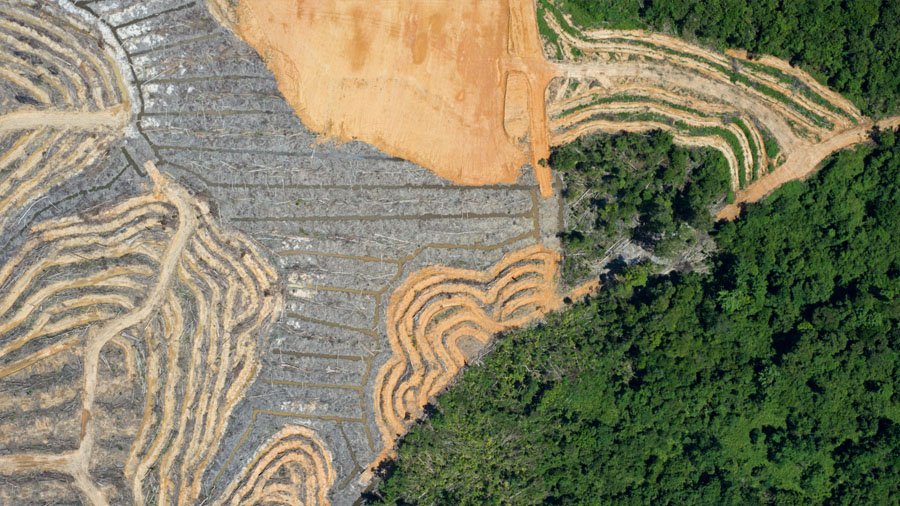
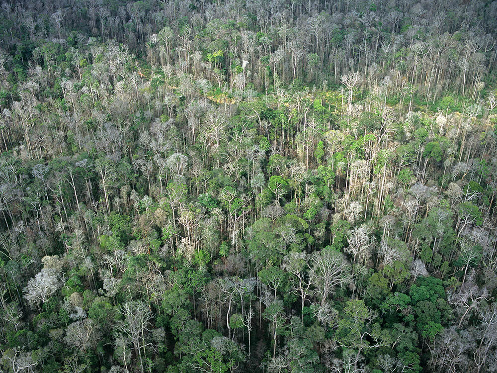
DEFORESTATION & FOREST DEGRADATION
Our monitoring approach that makes synergistic use of high-resolution optical and Radar satellite data, identifies the current state of forests, the extent and density of forest cover, and its changes over time. Historical trends of deforestation and forest degradation are derived that can be compared to current and future activity data. The resulting datasets form the basis for REDD+ and carbon accounting projects as well as conservation and restoration activties.
IMPACTS OF FIRE
Forest fires affect millions of hectares of tropical forests every year especially in SE-Asia and Brazil. Recurrent fires cause a successive serious degradation of the tropical forest ecosystem.
We use remote sensing to assess the impacts of the fires to the tropical forest ecosystem and on biodiversity spatially and temporally. Forest fires alter the composition of the forest vegetation by suppressing certain species and promoting other species. Often forest become more susceptible to fire, because subsequent fires burn with increased velocity and intensity and cause higher tree mortality. Forest managers can use data on fire impact and frequency prevention and to improve fire combat and adapt forest management.
FOREST DIVERSITY
TREE SPECIES/COMMUNITIES
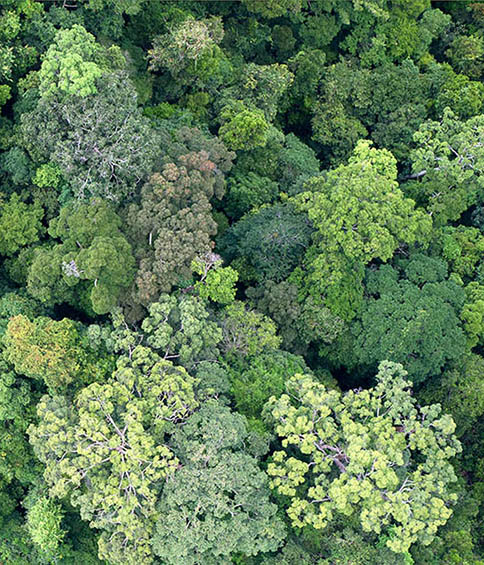
Different forest types require different management and protection measures. The dominant tree species and the extent of tree communities are often unknown variables when planning forest resources or supporting protected area management. By using multitemporal satellite data, different phenologies of tree species can be derived. By combining this information with digital terrain and digital surface models as well as structural canopy parameters, different forest types can be mapped at high spatial detail.
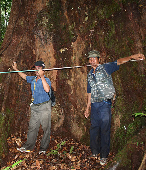
ASSESSING FOREST BIOMASS
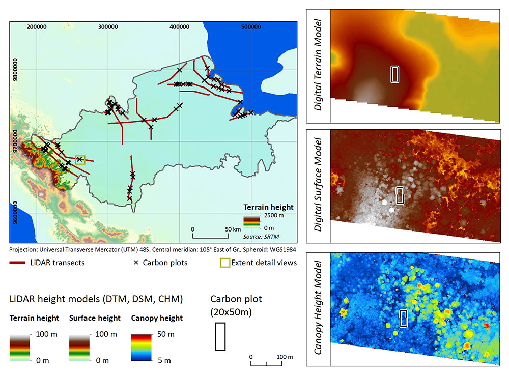
BACKGROUND ON LiDAR
LiDAR is an active, optical sensor that employs laser pulses to detect a given target (e.g. tree canopy, ground). The time it takes for the pulse to return from a target allows the device to calculate the distance between sensor and target. When combined with LiDAR’s extremely fine spatial resolution, one can generate highly detailed maps of objects on the ground, beneficial to any number of applications.
LiDAR based biomass assessment
Our LiDAR expertise provides you with one-stop services from flight survey planning to DSM/ DTM extraction and the delivery of secondary products (e.g. Biomass and carbon density maps). With accuracies in the centimeter range, airborne laser scanning (LiDAR - Light Detection and Ranging) allows generating precise aboveground biomass (AGB) models of forests. Derivatives of these models include information on carbon stocks and emission fluxes, which aid initiatives like High Carbon Stock (HCS) studies and sustainable forest management programs.
LiDAR technology ‘sees’ through vegetation layers and thus accurately assesses the three-dimensional structure of forest canopies. These products reveal changes in vegetation structure and biomass at unprecedented levels of detail and accuracy.
Consulting


When it comes to services, we make quality, technological excellence and customer satisfaction our unvarying priority. To find out more, please select a theme - we look forward to assisting you.
