
Your Supply Chain, Seen from Space
Gain insights into your sustainable sourcing
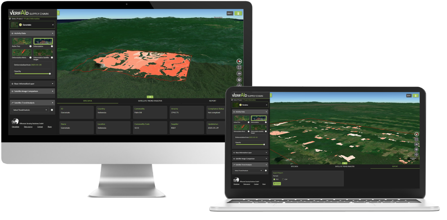
Identify deforestation & forest degradation
Our solution uses cutting-edge AI algorithms to automate complex workflows and increase accuracy.
- Tailored to the requirements set by the EUDR
- Grounded in scientific evidence and curated by earth observation experts
- Globally available data and not limited to specific commodities
Get near-real time alerts
Stay informed with near-real-time alerts, generated by continuous analysis of satellite imagery.
- Enhanced decision-making with timely updates on critical developments
- Proactively mitigate potential supply chain disruptions
- Build trust with forward-thinking environmental stewardship
Assess and mitigate risks
We offer a comprehensive deforestation risk assessment that aligns with the EUDR requirements.
- Determining risk level at a jurisdictional scale
- Supported by reliable data on deforestation and degradation
- Review of additional data and information for risk mitigation on a case-by-case level
Generate due diligence statements (DDS)
Rely on satellite data for an objective assessment enhancing transparency in the audit process.
- Compliance dashboard for deforestation
- Export of results in the format that suits your need (CSV, PDF, API)
- Effective and efficient communication of results for annual reporting
Interactive Platform and API as EUDR traceability solution
1
Onboard geolocations from your commodities origin. Either data from your supplier, from TRACES or from your own database. Send us your data in any format and we standardize it for you.
2
Our AI powered solution automatically analyses all available satellite imagery in the cloud. We use only proprietary science-based algorithms that are based on 25 years of experience in the earth observation sector.
3
Report on the EUDR compliance based on objective satellite data and generate an automated visual audit record for your due diligence statement. Export the results in the format that suits your need use our API to integrate it into your existing workflows.
How do we detect deforestation and forest degradation?
Data Basis
- Over 20k S-2 image pairs annotated by experts
- Inclusion of different deforestation and degradation patterns
- Forest-type specific models (tropical, temperate & boreal forests)
AI Model
- Deep learning model for deforestation and forest degradation
- Effective inspection of large areas through high degree of automation
- Based on U-Net and Attention U-Net
Detection
- Reliable detection of small- scale deforestation and forest degradation activities
- Global applicability and commodity-independence
- Continuous mapping since the EUDR cutoff date
