

Detection of marine plastic pollution
May 6, 2016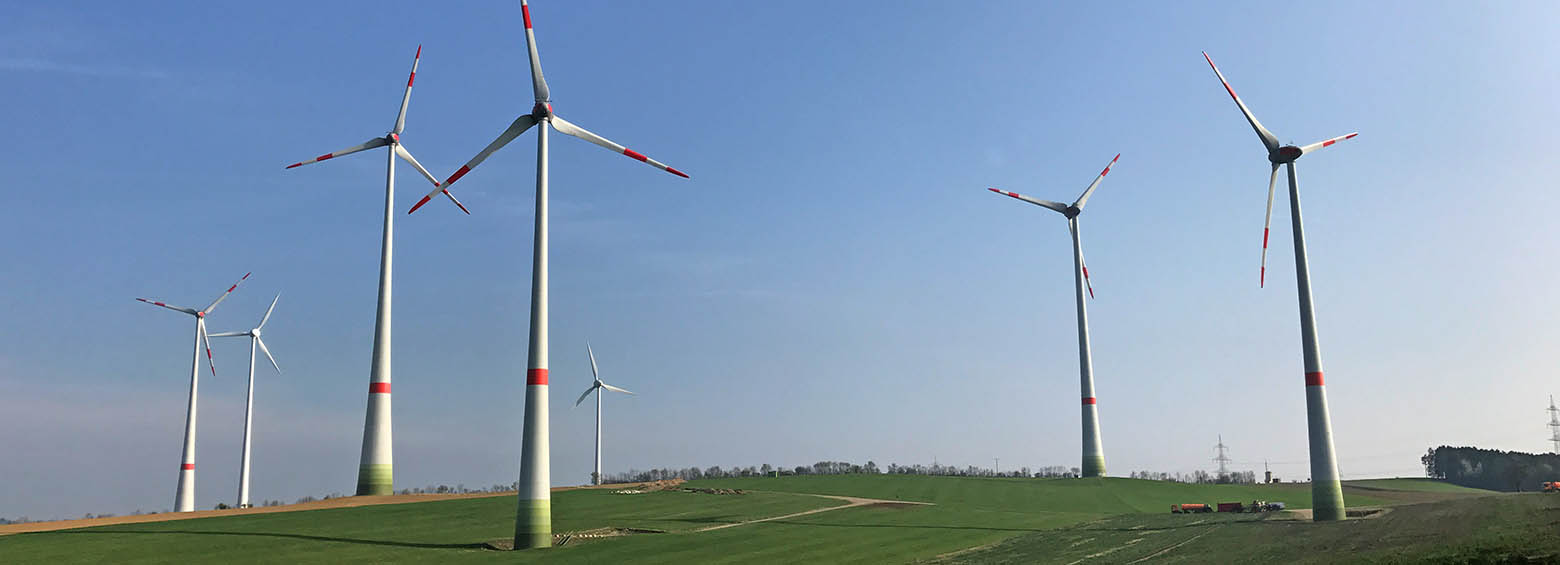
Spatial decision support for a sustainable and efficient energy transition
March 17, 2017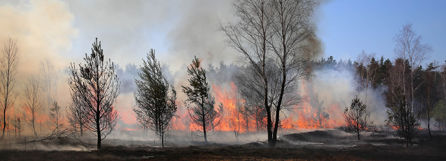
The multilateral research project FireSense aims at developing an improved fire information system to support environmental agencies and fire fighting. It includes early detection of active fires, assessment of vegetation and peat fires, derivation of trace gas and aerosol emissions and the mapping of burned areas. It integrates sensor derived data from satellites with newly developed and substantially improved algorithms. Existing experimental, and planned operational satellite instruments such as die FIREBIRD constellation enable essentially improved ways to monitor fires through higher spatial resolution, shorter revisit times and through an improved sensitivity for better quantitative characterizations of fires.
Fire detection by satellites
Fire management and firefighting require a timely and geographically precise detection of the origin and spread of active fires to combat. Information on fire intensity helps to better assess the impaczt of a forest fire. Especially small, low energy fires such as ground fires in forests or peat are difficult to be detected by existing technologies. New infrared satellites improve the large-scale detection of active fires. German satellite technology, which is being used as part of the FireBIRD mission (German Aerospace Center), provides new and improved ways to record active fire and fire intensity. The FireBIRD mission has two elements, TET-1 and BIROS, which use a combination of infrared (IR) and visual (VIS) optical cameras for remote sensing of high temperature events and normal temperature phenomena. The improved spatial and radiometrical resolution represents a great potential for improved information products. Advanced algorithms for fire characterization will be developed.
RSS RESPONSIBILITIES
- Mapping crop types
- Monitoring grassland use intensities
- Development of a spatial model for determining the potential of areas for the production of biomass
- Contribution to the spatial decision support system
Cloud-based services
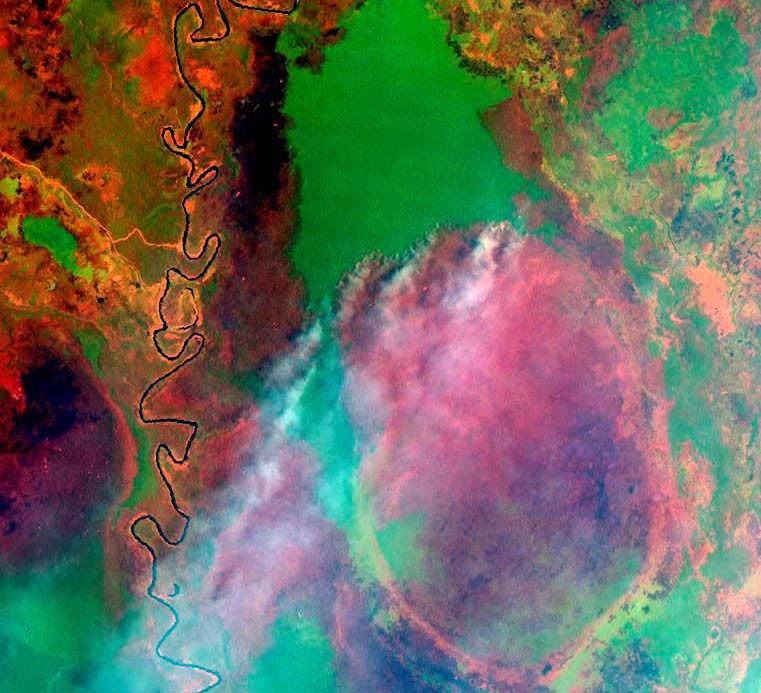
A cloud-based service for the analysis of historical fires and the automized detection of active fires is developed. Planning long-term measures in fire management to reduce emissions requires a detailed spatio-temporal recording of the fire history of the past 20 years. Satellite remote sensing allows the acquisition of measurable parameters such as historical fire frequency and fire interval per unit area. This fire baseline also allows for improved estimation of historical fire-related emissions. Only on the basis of such a "fire baseline" spatially adjusted fire management measures can be planned. A fire baseline is also the prerequisite to make actual emission reductions through fire management measurable and certified (for example, within the framework of the Verified Carbon Standard (VCS)) and thus to generate compensable shares in carbon trading.
Potential of application
The project results will allow to better estimate the gas and aerosol emissions of vegetation and peat fires. Through a a dedicated and efficient fire detection system based on remote sensing firefighting can be better targeted and potential emission avoided. Users of this system include environmental authorities, protected area managers and fire brigades.
Research partners
ZEBRIS GIS und Consulting GbR, Max-Planck-Institut für Chemie, Otto-Hahn-Institut, King's College London, Institute of Optical Sensor Systems, Deutsches Zentrum für Luft und Raumfahrt e.V.
Funding source
Zentrales Innovationsprogramm Mittelstand (ZIM)


