A new study published in collaboration with ICIPE this May looks at the effect of agro-ecological landscape fragmentation and its effect on honey bee habitats in Eastern Kenya.
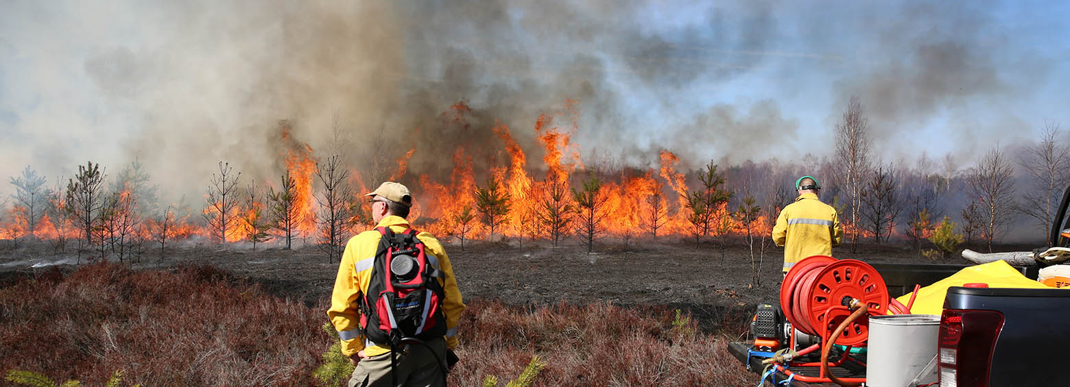
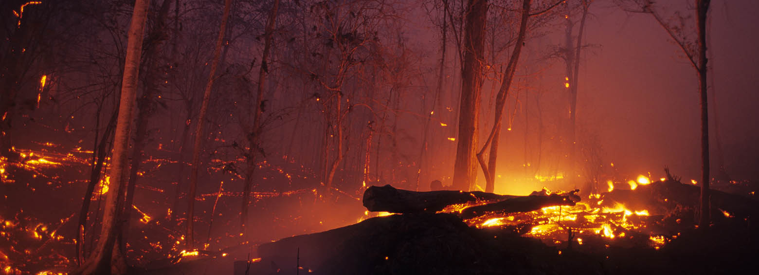
RSS is currently contributing to new research on fire detection and management technology, driven by the project "FireSense" and our drone was out recording infrared footage over a controlled burn in Brandenburg.
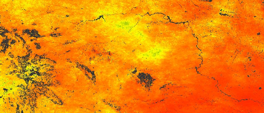
The ESA Fire CCI project focuses on the development of long time series of burned area constructed from multi sensor satellite data. It is part of the Climate Change Initiative (CCI) of the European Space Agency (ESA). As a project partner, RSS produced the first spatial estimates of burned area for the fire prone year 2015 using on high-resolution Sentinel-1 SAR imagery.
This website uses cookies to improve your experience. We'll assume you're ok with this, but you can opt-out if you wish. Cookie settingsOK
Privacy & Cookies Policy
Privacy Overview
This website uses cookies to improve your experience while you navigate through the website. Out of these cookies, the cookies that are categorized as necessary are stored on your browser as they are essential for the working of basic functionalities of the website. We also use third-party cookies that help us analyze and understand how you use this website. These cookies will be stored in your browser only with your consent. You also have the option to opt-out of these cookies. But opting out of some of these cookies may have an effect on your browsing experience.
Necessary cookies are absolutely essential for the website to function properly. This category only includes cookies that ensures basic functionalities and security features of the website. These cookies do not store any personal information.
Any cookies that may not be particularly necessary for the website to function and is used specifically to collect user personal data via analytics, ads, other embedded contents are termed as non-necessary cookies. It is mandatory to procure user consent prior to running these cookies on your website.