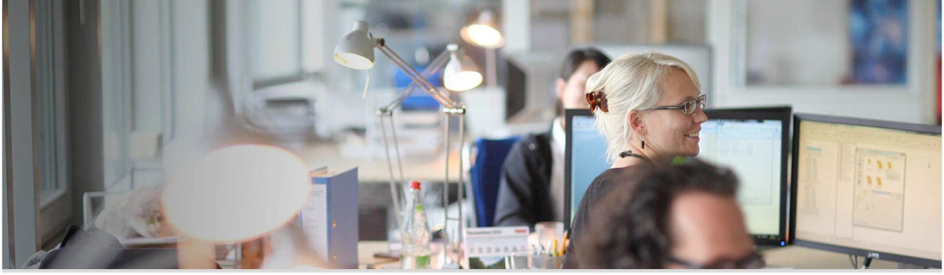
LERNEN SIE DAS TEAM KENNEN
20 Jahre Erfahrung haben uns zu einem der führenden Unternehmen für Erdbeobachtung gemacht. Wir arbeiten ständig an Innovationen unter Verwendung neuer Technologien, um zuverlässige Geoinformationen für eine nachhaltige Zukunft bereitzustellen. Finden Sie mehr heraus...
WIR SIND…
INNOVATIV
Unser Team trägt aktiv zum neuesten Stand der Forschung bei und treibt gerne Forschnungsthemen voran, von der Daten-getriebenen Wissenschaft bis hin zu automatisierten Verarbeitung für kommende Satellitendaten. Wir investieren in den Fortschritt und integrieren die neuesten Technologien um die bestmöglichen Standards zu erreichen, die höchsten Kundenerwartungen zu erfüllen und uns an die aktuelle Nachfrage anzupassen.
KOMPETENT
Die Remote Sensing Solutions GmbH (RSS) hat sich mit 20 Jahren Erfahrung zu einem der führenden Unternehmen für Erdbeobachtung in Deutschland entwickelt. Unser engagiertes Team von Experten mit akademischem Hintergrund greift auf ein umfangreiches praktisches und interdisziplinäres Wissen zurück.
VERNETZT
Zusammenarbeit ist der Schlüssel zu neuen Erkenntnissen, zum Wissensaustausch und letztlich zum Vorteil aller Beteiligten aus Wissenschaft und Praxis. Deshalb erweitern wir ständig unser Netzwerk auf internationalen Konferenzen und Messen und arbeiten zunehmend mit Kommunen auf lokaler Ebene zusammen. Wir pflegen und erweitern ständig unser Netzwerk von zuverlässigen Forschungs- und Geschäftspartnern.
Besuchen Sie uns in "THE LAIM" München
DAS TEAM
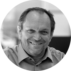
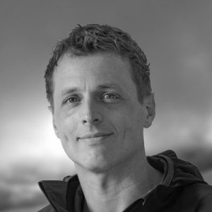
Prof. Dr. FLORIAN SIEGERT
With extensive knowledge in ecology and more than 20 years of remote sensing experience, Florian initiates, designs and manages large international projects. He teaches environmental monitoring at the Ludwig-Maximilians-University.
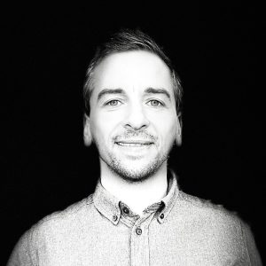
Dr. JONAS FRANKE
Jonas Franke, PhD, is a geographer and data scientist specializing in operational Earth Observation methods for environmental monitoring, policy impact, and sustainable development.
WERNER WIEDEMANN
Werner is specialized in digital image processing for a wide range of satellite instruments, as well as GIS-based landscape analyses and modeling. He studied cartography and geoinformatics in Munich.

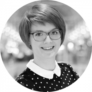
Anna Seiche
With degrees in geography and geoinformatics, Anna develops machine learning solutions that enhance environmental monitoring and streamline data analysis, focusing on detecting landscape changes and natural hazards.
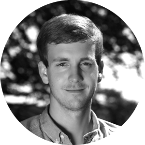
Johannes Brunner
Johannes is a geographer specializing in earth observation and environmental monitoring and modelling. He has a background in the development, risk assessment, and monitoring of nature-based solutions.
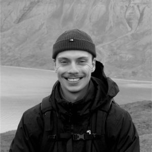
Janik Hoffmann
With a background in Geography, Janik specialized in earth observation for environmental applications with a focus on SAR. In his work, he utilizes multi-sensor remote sensing data and machine learning for monitoring land surface processes.
Dr. Maximilian Schwarz
Maximilian has a background in geography and climate and environmental sciences. His research focus lies on large scale analyses of environmental related factors that explain the relationships between natural resources and human activities.

Sathish Vaithiyanadhan
Sathish is a Geoinformatics specialist and air quality modeler with a background in remote sensing and climate modeling. He is currently pursuing a PhD at the University of Augsburg, focusing on urban air quality and its health impacts in Augsburg.

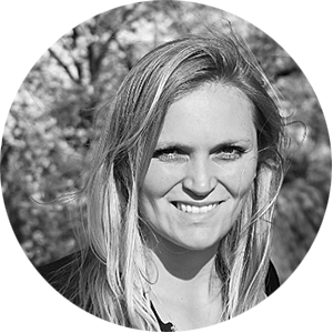
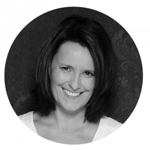
Katrin Wernicke
Katrin is a remote sensing and GIS specialist with a background in geography and geoinformatics. Her work focuses on the application of machine learning processes for environmental monitoring.

Isabel Augscheller
Isabel has a background in geography and climate and environmental sciences with focus on remote sensing and GIS. Her work is dedicated to environmental monitoring and satellite image processing.
Clara Siegert
Clara studied geography with focus on remote sensing. She specializes in cloud processing of large image data sets and automatized processing using machine learning algorithms.

Dr. Tuyen Ha Van
Tuyen is a remote sensing and GIS specialist with expertise in harnessing geospatial data, cloud computing, and deep learning to study and monitor environmental changes.

Gretty Hasibuan
Gretty is pursuing her master's thesis at RSS, focusing on climate change modeling and air contamination. She studies Sustainable Resource Management at TUM, specializing in landscape management, GIS, and remote sensing.
STEFAN KIRMAIER
Stefan is a remote sensing and GIS specialist with a background in geoinformatics. His work deals predominantly with process and workflow automatization, as well as software development.
Deha Umarhadi
Deha has a background in remote sensing and GIS. His focus is on the utilization of multi-sensor remote sensing data for forest and environmental monitoring, especially in tropical peatlands.

Levente Papp
Levente is a Remote Sensing and GIS specialist. He is an expert in object-based image analysis.
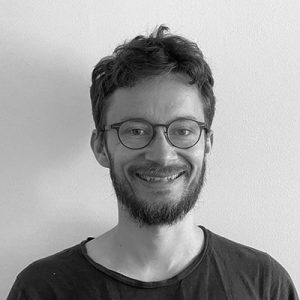
Lukas Aschenbrenner
Lukas is a geographer with focus on forest related topics. He works on the application of deep learning in monitoring tasks.
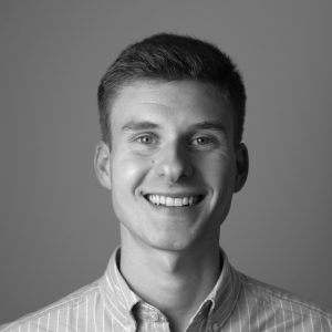
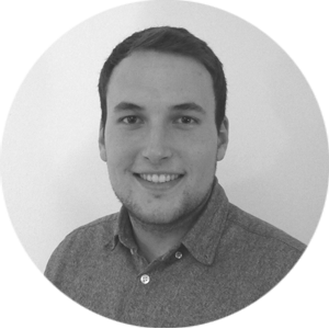
Tobias Beetz
Tobias holds a double degree in computer science and geography. In previous projects he gained a deep understanding of the app development cycle, which he brings to his current role as a full-stack developer.
Kevin Kuonath
Kevin is a software developer with a background in machine learning who studied Electrical Engineering at TU Munich. His interest in conservation and environmental monitoring finally led him to apply his skills to the field of remote sensing.
Hannes Flaschenträger
Hannes is a software developer with a strong background in geography. He is specialized in web development and web mapping applications
Claudia Roeben
Claudia supports the management with coordination and organizational work
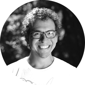
Juilson Jubanski
Juilson studied geodesy at the Karlsruhe Institute of Technology (KIT). He is part of the team and specializes in photogrammetric processing and analysis of aerial photographs and LiDAR data.
Marina Fischer
Marina is specialized in Geomatics Engineering. She has a strong background in the fields of geodesy and geoinformatics.
UNSERE KUNDEN